If you own or are buying property in Maine, the two sources that matter are the FEMA Flood Map Service Center and the Maine Flood Hazard Map. Pull the effective FIRM or a FIRMETTE, confirm your parcel’s zone, and check whether flood insurance is required before you sign anything. Your zone designation drives insurance costs, permit rules, and whether your lender will require coverage at closing.
TL;DR:
- Standard flood zone maps may be outdated as flood risks can increase due to climate change and map updates; always check the effective FIRM for current regulations.
- Flood insurance is required by lenders for structures in mapped flood-prone areas, but nearly 75% of properties in these zones do not carry coverage, increasing financial risk.
- Coastal properties in high-hazard zones like VE face stricter building codes and higher insurance costs, especially as sea levels rise and boundaries potentially shift inland.
- Verifying flood-zone status early with official FIRM and Elevation Certificates before writing offers can prevent costly delays or surprises at closing.
- Local floodplain ordinances vary, with some towns mandating elevations above the base flood level, impacting permitting, insurance, and property value considerations.
Table of Contents
- Where to find Maine flood-zone maps and which viewer to trust
- How to read FEMA flood zone codes used in Maine
- Why effective, pending, and preliminary maps carry different weight
- What flood-zone status means for insurance, mortgages, and local rules in Maine
- How to confirm your property’s official flood-zone determination
- Practical checklist for buyers and sellers from a Maine REALTOR®
- Differences in flood zone regulations and insurance implications across various Maine counties or municipalities
- Historical flood data and trends in Maine to understand flood risk evolution
- Available state-level resources or assistance programs in Maine for flood mitigation and insurance
- How climate change and sea-level rise projections specifically affect flood zones in Maine
- Why I tell every client to pull their FIRMETTE before we write an offer
- How RealtorMaine can help with flood-zone questions
- FAQ
- Sources
Where to find Maine flood-zone maps and which viewer to trust
The FEMA Flood Map Service Center is the official national source for Flood Insurance Rate Maps (FIRMs) and the FIRMETTEs lenders and local officials accept as proof of zone status. The Maine Flood Hazard Map, maintained through the state’s ArcGIS viewer, adds useful context layers including the National Flood Hazard Layer (NFHL), older Q3 data, and preliminary or pending map changes. The state’s own mapping guidance is direct about the limits of that viewer: it is a representation of flood zones and does not replace the official effective FIRM.
To find your panel number and effective date, search your address on the FEMA MSC, note the panel number printed on the map, and check the effective date stamped in the corner. From there:
- Search your address on FEMA’s MSC to locate your panel and download a free FIRMETTE.
- Use the Maine Flood Hazard Map for a quick visual check, but treat Q3 layers as approximate, not final.
- Record the panel number and effective date exactly as shown; you will need both for insurance and permitting.
How to read FEMA flood zone codes used in Maine
Reading the code correctly tells you what kind of risk you are looking at and what documentation you will eventually need.
- Zone A and AE: inside the SFHA; AE includes a calculated Base Flood Elevation (BFE), A often does not.
- Zone VE: coastal high-hazard area with wave action; typically the strictest building and insurance requirements.
- Zone AO and AH: shallow flooding, often from ponding or sheet flow, usually with shallow average depths.
- Zone X, B, or C: low-to-moderate risk, outside the mapped SFHA.
- Floodway: the channel and adjacent land reserved to carry flood flows; development here is heavily restricted.
Under Risk Rating 2.0, premiums now weigh property-specific factors like elevation, distance to water, and construction type more heavily than the zone label alone, so two homes in the same zone can carry different rates. Zone still matters for lenders, though, since it determines whether coverage is mandatory. A sizable share of flood claims nationally occur outside mapped high-risk zones, which is one reason Maine’s own floodplain program encourages owners in X, B, or C zones to consider coverage rather than assume they are exempt.
Why effective, pending, and preliminary maps carry different weight

FEMA and local officials only enforce the effective FIRM, the version currently in legal force for permitting, zoning, and lending. A preliminary map is a draft under review, often circulated for public comment before adoption. A pending map has been adopted but has not yet reached its effective date, usually a window of several months. Maine’s mapping instructions stress that regardless of what a viewer displays, the effective FIRM is what governs regulatory decisions right now.
If your property sits near a mapped boundary or you see a preliminary layer on the state viewer, take these steps:
- Save a FIRMETTE of the current effective map and note its effective date.
- Check whether a preliminary or pending map exists for your area and when it is scheduled to take effect.
- Contact your lender or local floodplain administrator if a pending change could shift your parcel into or out of the SFHA.
What flood-zone status means for insurance, mortgages, and local rules in Maine
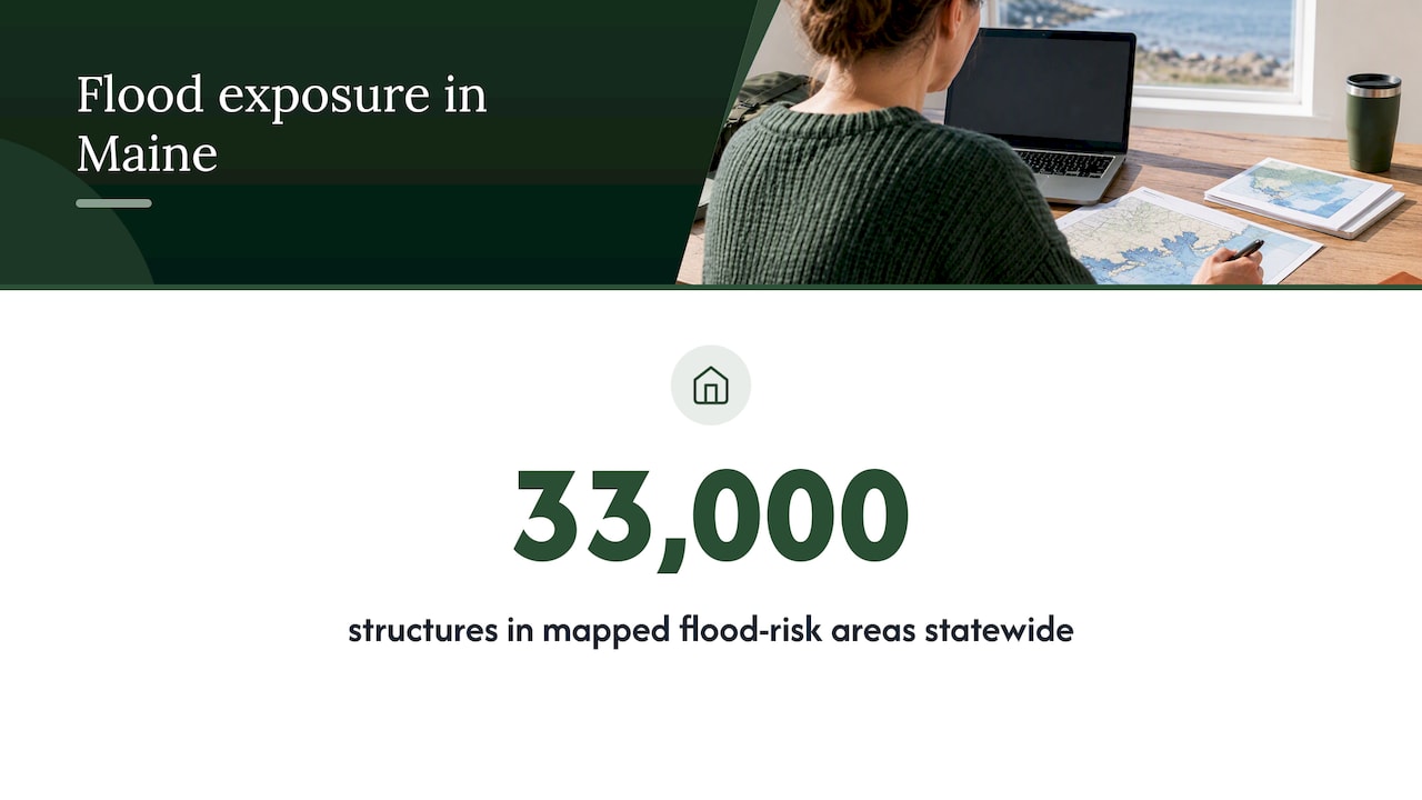
Lenders on federally backed mortgages generally require flood insurance whenever a structure sits in a mapped SFHA, regardless of zone letter. Maine’s floodplain program reports that roughly 33,000 structures across the state sit in mapped flood-risk areas, yet about 75% of homes and businesses within those floodplains carry no flood insurance at all, even though more than 5,000 NFIP policies are currently in force statewide covering over $1.4 billion in coverage, according to the Maine Office of Community Affairs.
- New NFIP policies usually carry a waiting period before coverage takes effect.
- Communities enrolled in the Community Rating System (CRS) earn premium discounts ranging from 5% to 45%, and FEMA reports Maine CRS policyholders save an average amount annually, representing a moderate percentage off typical premiums.
- Local ordinances sometimes add “freeboard,” requiring new construction to sit a foot or more above the base flood elevation, which can affect both permitting and insurance pricing.
- Elevating mechanical systems, adding flood openings, or raising a structure’s lowest floor are common mitigation steps that can lower premiums over time.
Pro Tip: Ask your insurance agent whether your community participates in CRS before you shop rates; the discount applies automatically if it does.
How to confirm your property’s official flood-zone determination
Getting a document that lenders and town offices will actually accept takes a few concrete steps, not just a glance at a map viewer.
- Pull the effective FIRM and a free FIRMETTE from the FEMA Map Service Center, recording the panel number and effective date.
- Use the Maine Flood Hazard Map for context, but default to the FIRMETTE for anything regulatory, since the state viewer explicitly says it is not a substitute.
- Order an Elevation Certificate or a licensed survey if your lender or insurer needs a precise lowest-floor elevation, especially near a zone boundary.
- Request a Letter of Map Amendment (LOMA) from FEMA if you believe your structure was mapped into an SFHA in error.
- Contact your local floodplain administrator early; they can confirm which documents your town requires for permits or disclosures.
Practical checklist for buyers and sellers from a Maine REALTOR®
Flood status shows up at several points in a Maine transaction, and catching it early avoids last-minute scrambles before closing.
- Buyers should request a FIRMETTE and any seller flood disclosures as soon as a property goes under contract.
- Ask the seller directly about past flood claims or water intrusion, even outside the mapped SFHA.
- Budget for insurance and any mitigation costs before finalizing your offer, not after.
- Sellers should have a current FIRMETTE and, if available, an Elevation Certificate ready for buyers’ agents.
- Reasonably priced mitigation, like sealing a sump pump system or adding flood vents, can improve both saleability and insurance pricing.
Pro Tip: Order your FIRMETTE the same week you go under contract. It is free, takes minutes, and gives your lender time to flag insurance requirements before you’re racing the closing date.
A REALTOR® who works through this regularly can coordinate the FIRMETTE pull, connect you with a surveyor for an Elevation Certificate, and time that paperwork so it lands before your inspection deadline rather than after.
Differences in flood zone regulations and insurance implications across various Maine counties or municipalities
Flood risk in Maine is not evenly distributed, and neither is local regulation. Coastal municipalities along Cumberland, York, Sagadahoc, and Knox counties deal heavily with Zone VE wave-hazard areas, where building codes tend to be strictest and insurance costs climb fastest. Inland and river-adjacent communities along the Kennebec, Androscoggin, and Penobscot watersheds more often see Zone A and AE designations tied to spring runoff and ice jams rather than coastal surge.
Maine’s floodplain program maintains a model ordinance that towns can adopt, but individual municipalities decide how strictly to apply it. Some communities add freeboard requirements above the state’s standard, requiring new construction to sit higher above the base flood elevation than federal rules alone demand. Others participate in the Community Rating System, which lowers premiums for every policyholder in that town, while neighboring towns without a CRS rating see no such discount. That means two similar homes a few miles apart, one in a CRS community and one not, can face meaningfully different insurance costs even with identical FIRM zones.
Local floodplain administrators, usually based in the town office or planning department, are the ones who interpret and enforce these rules day to day. Before assuming a rule from one Maine town applies statewide, it is worth confirming directly with the municipality where the property sits, since permit requirements, freeboard standards, and CRS participation vary town by town.
Historical flood data and trends in Maine to understand flood risk evolution
Maine’s flood history is a mix of seasonal river flooding, ice jam events, and coastal storm surge, and the pattern has shifted over recent decades as storm intensity and precipitation patterns have changed. River systems like the Kennebec and Penobscot have long histories of spring flooding tied to snowmelt and ice breakup, while coastal counties face a growing frequency of nor’easter and storm surge events layered on top of gradually rising baseline water levels.
The scale of exposure is not small. Maine’s floodplain management program counts roughly 33,000 structures sitting within mapped flood-risk areas statewide, a figure that reflects both historical floodplain mapping and the reality that development has continued in and near those zones over time, according to the Maine Office of Community Affairs. FEMA’s own flood risk reports for Maine counties, including detailed studies for areas like Sagadahoc County, go further than a standard FIRM by modeling flood depth and coastal wave-height grids, which show that within a single mapped zone, some parcels face meaningfully deeper expected flooding than others nearby.
That granularity matters for understanding trend, not just current status. A property that sat safely outside a mapped SFHA a decade ago may now sit closer to a boundary as maps are updated with better elevation data and storm history. Reviewing a panel’s effective date alongside any prior FIRM revisions for that area gives a rough sense of whether risk has been trending up, down, or holding steady for that specific parcel.
Available state-level resources or assistance programs in Maine for flood mitigation and insurance
Maine’s floodplain management program, housed within the Maine Office of Community Affairs, is the primary state resource for both mapping guidance and mitigation support. Beyond maintaining the state’s flood hazard viewer, the program publishes a model floodplain ordinance that towns can adopt and offers direct guidance to property owners trying to confirm zone status or understand local permit requirements.
On the mitigation side, FEMA’s Hazard Mitigation Assistance programs provide grant funding that Maine communities and, in some cases, individual homeowners can tap to fund measures like elevating structures, installing flood openings, or other projects that reduce future flood exposure. These grants typically flow through state or local government applications rather than directly to homeowners, so the local floodplain administrator or regional planning office is usually the right first contact.
For insurance specifically, the Community Rating System rewards towns that go beyond minimum federal floodplain standards with premium discounts for every policyholder in that community, and Maine’s program office can tell you whether your town participates. Between the state program, FEMA’s mitigation grants, and CRS discounts, there is more support available than most Maine property owners realize, but almost all of it requires an initial call to the town or state office rather than an online application.
How climate change and sea-level rise projections specifically affect flood zones in Maine
Maine’s coastline is long, low-lying in many stretches, and directly exposed to rising sea levels, which means flood maps drawn even a decade ago may understate current risk in some coastal areas. As sea levels rise, the baseline water elevation that storm surge builds on top of also rises, pushing the effective reach of a given storm further inland than older modeling assumed.
This matters most for coastal counties where Zone VE and AE designations are already tied to storm surge and wave action. A modest rise in mean sea level can shift the boundary of a mapped SFHA inland, which is part of why FEMA periodically updates coastal flood studies and why preliminary maps sometimes show expanded high-risk areas compared to the current effective FIRM. Property owners near the current zone boundary in coastal Maine are the ones most likely to see their official status change in a future map update.
Inland river flooding is affected differently. Changing precipitation patterns can increase the frequency of heavy rainfall events that drive spring and fall flooding along Maine’s river systems, independent of sea level. Both trends point toward the same practical takeaway: an effective FIRM is accurate as of its effective date, but it is not a permanent guarantee. Checking for pending or preliminary map updates periodically, especially for coastal and river-adjacent property, is a reasonable habit rather than an overreaction.
Why I tell every client to pull their FIRMETTE before we write an offer
Maine’s coastline and river systems create sharp local variation. Two lots on the same road can sit in different zones because of a few feet of elevation or a stream setback most buyers never notice. Verifying the official map early, before financing is underway, avoids the scramble that comes from finding out at closing that insurance is mandatory and unbudgeted.
— David
How RealtorMaine can help with flood-zone questions
Flood-zone issues rarely show up as a single question. They touch financing, insurance timing, and sometimes negotiation over mitigation costs, and we work through all three with clients across central and southern Maine.

When a property we are showing or listing sits near a mapped zone boundary, we coordinate the FIRMETTE pull, recommend a surveyor when an Elevation Certificate is warranted, and help time that paperwork so it does not stall your closing. If supplemental coverage questions come up, such as sump pump or water backup protection, a licensed insurance broker can walk through coverage options alongside your standard flood policy.
- Order and interpret your FIRMETTE before you write or accept an offer.
- Connect you with a surveyor for an Elevation Certificate when a lender requires one.
- Advise on insurance timing and negotiation strategy when a mapped change affects price or terms.
If you are buying or selling in a Maine flood zone, reach out through our Buying a Home and Selling My Home services and we will walk through what your specific parcel requires before you are under contract.
FAQ
What’s considered the worst flood zone to be in?
Zone VE, the coastal high-hazard zone with wave action, generally carries the strictest building requirements and highest insurance costs among FEMA’s flood zone codes. Floodway areas, reserved to carry flood flows, face the heaviest development restrictions of any designation.
What was the worst flood in Maine history?
Maine has experienced multiple significant flood events tied to spring snowmelt, ice jams, and coastal storm surge over its history. Rather than naming a single “worst” event, Maine’s floodplain management program tracks cumulative exposure, noting that roughly 33,000 structures statewide currently sit within mapped flood-risk areas as a result of this long history, according to the Maine Office of Community Affairs.
What is the average cost of flood insurance in Maine?
Maine policyholders in Community Rating System communities save an average of about $162 a year, roughly 15% off typical premiums, through CRS discounts FEMA administers. Actual premiums vary by zone, elevation, and building features under Risk Rating 2.0, so getting a quote tied to your specific property is the only way to know your exact cost.
How do I know if my property requires flood insurance from my lender?
Lenders on federally backed mortgages require flood insurance when a structure sits within a mapped Special Flood Hazard Area on the effective FIRM. Pulling a FIRMETTE from the FEMA Map Service Center confirms your zone and settles the question before you reach closing.
Can I appeal or change my property’s flood zone designation?
Yes, if you believe your structure was mapped into a Special Flood Hazard Area in error, you can request a Letter of Map Amendment (LOMA) from FEMA. An Elevation Certificate or licensed survey is usually needed to support that request.